


We leave Lugo behind, crossing the Miño River via the Ponte Vella—a bridge of Roman origin. Gradually, city streets give way to hamlets, fields, and hills, as the Way leads us through a landscape where every era has left its mark.
Over the centuries, people blazed trails, harnessed natural resources, and organized the landscape, leaving behind small and large traces of their history. Some are easily recognized; others go unnoticed, hidden amidst the vegetation or woven into the daily life of the villages.
Along this stretch, PEFC invites you to discover those traces and view the forest from a different perspective: as a space that offers us resources, preserves our heritage, and requires responsible management to remain part of our future.
PATHS UPON PATHS
Long before pilgrims followed the yellow arrows to Compostela, the Romans had already built an extensive network of roads to connect cities, transport goods, and facilitate the movement of people.
The route leading out of Lugo preserves part of that history. From the city walls, the Way descends along the path of an ancient road and crosses the Miño River via a bridge of Roman origin. Further on, near Santalla de Bóveda, the Via XIX—which connected Bracara Augusta (Braga) with Lucus Augusti (Lugo) via Iria Flavia (Padrón)—once ran.
Roman roads were true feats of engineering. Their construction required surveying the terrain, preparing the roadbed with various materials, overcoming changes in elevation, and ensuring proper drainage. Stone played a fundamental role, both in the construction of bridges and roadways and in marking the routes.
In San Romao da Retorta, one can see a replica of a Roman milestone dedicated to the Emperor Caligula and dating back to 40 AD—one of the most interesting pieces of evidence regarding ancient transportation routes in this area.
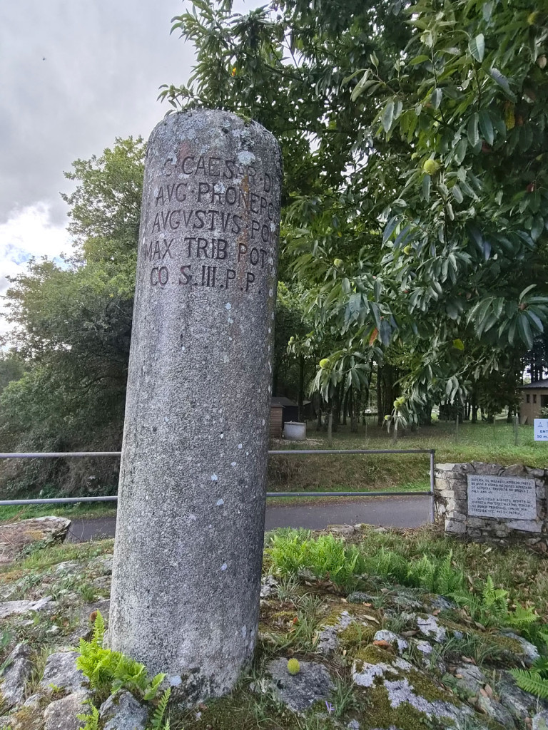
Milestones were large stone columns placed alongside Roman roads to mark distances and attest to imperial authority. The original specimen from San Romao, standing over two meters tall, bears a Latin inscription listing the emperor’s titles. Its discovery confirms the presence of such infrastructure in the area, although it does not, on its own, allow for the exact route of the road to be determined.
The story of this milestone is also remarkable. In the 19th century, it was moved from its original location and repurposed as a column to support the roof of a shed. Years later, once its historical value was recognized, it was removed and eventually taken to Astorga (León); today, it is housed in the Diocesan Museum of Astorga—also known as the Museum of the Ways (Museo de los Caminos)—located within the Episcopal Palace designed by Antoni Gaudí.
Located near the church of San Romao, this reproduction keeps alive the memory of ancient transportation routes. It is not the only milestone known in the municipality of Guntín; another specimen, dedicated to the Emperor Marcus Aurelius and found in Entrambasaugas, is housed in the Provincial Museum of Lugo.
Next to the replica of the milestone, there is also a plaque from the Human Rights Route, an initiative that follows the Primitive Way from Oviedo to Santiago de Compostela. Along the route, thirty bronze plaques commemorate the thirty articles of the Universal Declaration of Human Rights. The one at San Romao is dedicated to Article 22, which recognizes the right to social security.
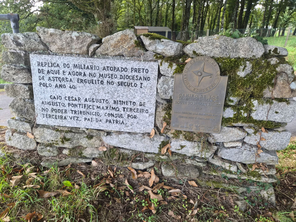
Centuries later, the Primitive Way continues to traverse these lands. Milestone markers have given way to waymarkers and yellow arrows, yet the paths remain far more than mere routes of communication: they are places of encounter, the exchange of ideas, and the transmission of values that connect different people, territories, and eras.
WHO MOVED THE BOUNDARY MARKER?
Stones served purposes beyond merely constructing roads or marking distances. In Galicia, they have also long been used to demarcate landholdings, woodlands, and properties. These are known as (marcos) boundary markers—stones, whether small or large, placed at specific points on the terrain to indicate where one property ends and the next begins.
Many of these boundary markers have been part of the rural landscape for decades or even centuries. Some are easily recognizable, while others remain half-hidden amidst the vegetation, beside a path, or deep in the woods. They were so significant that they even found their way into Galician humor and popular expressions—such as “De marco a marco non hai arco” (meaning the furrow separating two plots must run straight between the markers, without veering into a neighbor’s property). Who hasn’t heard a story about a neighbor moving a marker to gain a few meters of land?
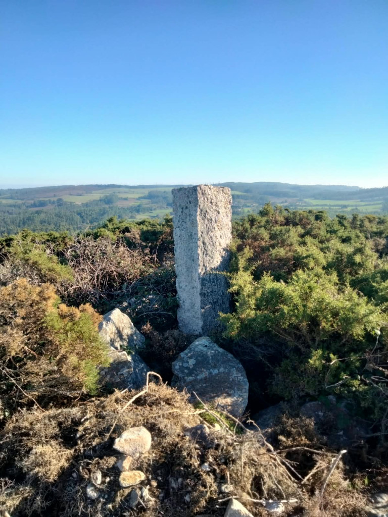
Today, property boundaries can also be marked with stakes or other elements, while surveying techniques and geographic coordinates allow them to be represented with greater precision. Materials and tools may change, but the purpose remains the same: to determine where one property ends and the next begins.
Yet behind these anecdotes lies a fundamental issue: knowing and respecting property boundaries. In the Galician countryside, where small private plots coexist with communal woodlands held in common ownership, clear demarcation is essential to avoid conflicts and determine who has the authority to make decisions regarding each area of land.
In sustainable forest management, correctly identifying land and its boundaries is an important step for planning operations, organizing harvesting activities, and assuming the responsibilities incumbent upon each owner or community.
Thus, from Roman milestones to the boundary markers on our hills, stones continue to tell us how people organized and used the land over time.
STONES THAT HOLD MEMORY
Along the Primitive Way, small churches and cemeteries are part of the landscape of the villages. These places preserve customs, memories, and ways of understanding community life, while also offering insight into traditional architecture and materials.
You may have already noticed some of them. In Soutomerille, in the municipality of Castroverde, a tiny cemetery with barely three graves is considered one of the smallest in Galicia. Further along, in San Romao da Retorta, all the headstones are arranged individually on the ground.
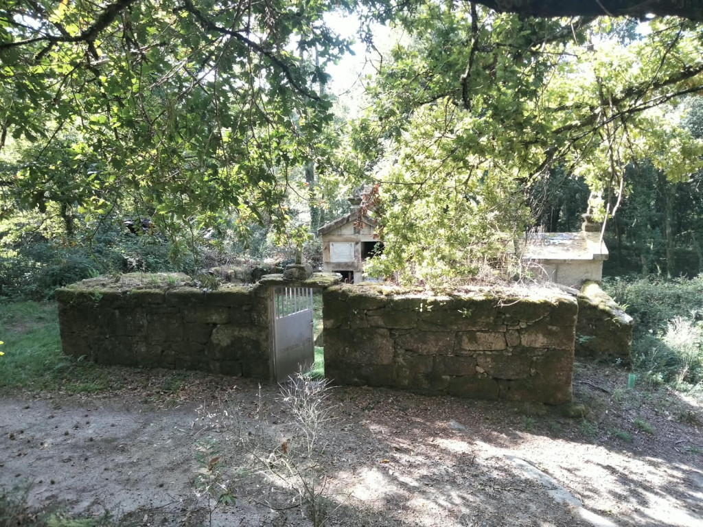
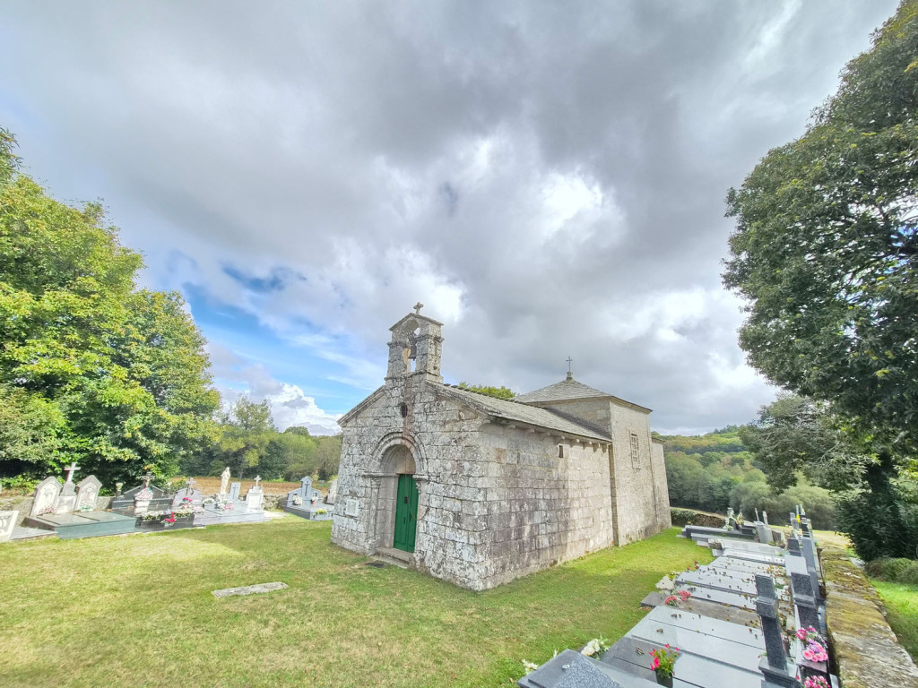
These small spaces are part of the cultural heritage of rural areas. Stone, so prominent in churches, walls, and graves, has for centuries been an integral part of the traditions of Galician communities.
But it was not the only material. Wood was also present in churches, in furniture, in ceremonial objects, and in coffins—forming part of customs that have persisted to the present day.
Currently, companies in Galicia continue to process and market wood products for these and other uses. A local example can be found in Lugo, where Grupo Lamas Lucus holds PEFC Chain of Custody certification for the sale of coffins—a certification that makes it possible to identify certified products and verify their responsible origin.
It is an example of how a natural, renewable resource can accompany us through very different stages of life, and of how the sustainable management of forests is also reflected in products closely linked to our traditions.
AN ROMAO, A BREAK ALONG THE WAY
After covering the stretch that separates Lugo from San Romao da Retorta, we arrive at a small locality in the municipality of Guntín, where the Way offers an opportunity to rest and take in the landscape at a leisurely pace.
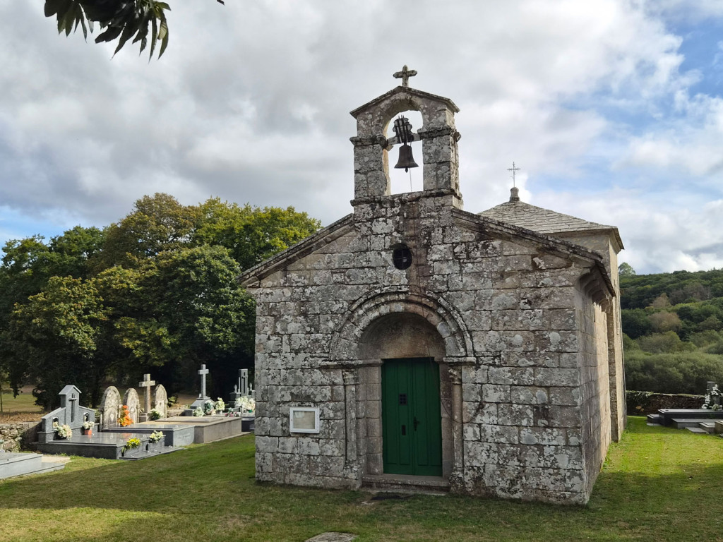
The church of San Romao, of Romanesque origin, preserves part of the medieval history of this territory. Surrounding it is a traditional cemetery, while nearby, a replica of a Roman milestone serves as a testament to vastly different eras and customs.
It is a good place to take a break, regain your strength, and discover those small details that sometimes go unnoticed when we are walking. The tranquility of the surroundings, the traditional architecture, and the rural landscape serve as a reminder that the Way is not defined solely by grand monuments; it is also made up of simple places that have preserved their identity.
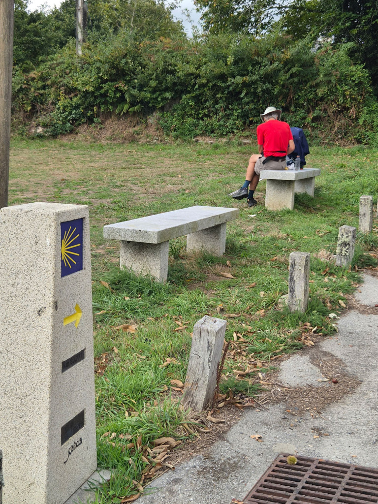
Along the route from Lugo, there are other points of interest, such as the Romanesque church of San Miguel de Bacurín or the unique late-Roman monument of Santalla de Bóveda, known for its wall paintings featuring birds and botanical motifs. Access to the latter may be restricted for conservation reasons, so it is advisable to check the visiting conditions in advance.
THE ROLE OF PEFC
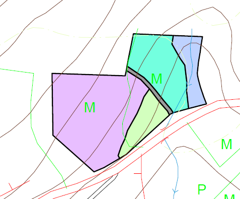
The paths, boundary markers, and traditional structures serve as a reminder that the Galician uplands are also a territory with a history, owners, and methods of land use that have evolved over the centuries.
To manage a forest sustainably, the first step is to understand it: identifying its total area, its boundaries, the resources it offers, and the natural and cultural values that must be preserved. PEFC certification promotes planned and responsible forest management, which respects property rights and protects the heritage elements present within the area.
At the same time, PEFC Chain of Custody certification makes it possible to track the origin of certified forest products, such as those made from wood, from the forest to the consumer.
Because caring for the forest is not just about looking after the trees: it also means respecting its boundaries, preserving its history, and making responsible use of the resources it offers us.

Project promoted by the Xunta de Galicia under the “O Teu Xacobeo” program